Through this post, I would like to share a recent experience I had, about what we could achieve with a little alertness from ourselves. In our country - with attitudes where, helping a blind person to cross a road is considered as a social work or activism - we are far too much engrossed in our own lives. Activism is something described as an action taken to make a change. With our duties we wont attempt to make changes, but to fulfill our responsibilities towards our society. The activism of 'India against Corruption' and 'Bharat Swabhiman' in the recent weeks have had a profound impact on me, at least to not shy away from a social responsibility if confronted with. This post wont be about sermonizing nor about bragging, I am as much guilty of the things mentioned as any average Indian would be.
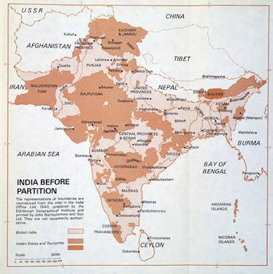
Time and again we keep reading about instances where the India map has been compromised with. Most nations and publications world over show the Pok as a part of Pakistan and Aksai Chin as part of China. A few years ago Bajaj Allianz group had put up this map on their website and were riled for it. At the height of our complaints about racism in Australia, we found that their maps were all depicting our country wrongly and we found one more reason to blame their attitudes. The maps were there before too, but yes pointing at them at that time gave us brownie points and we shamelessly used them to twist a few arms.
Last year, we had to publish a few India maps for our company brochure and bingo I found out why it could be such a big deal for publications to make such mistakes. We needed a 300 DPI or higher resolution image of the map and our foreign counterparts published the map found in UN and elsewhere in the world, except for India. On our objections, we were assigned the task to get the right maps. We were unable to find a suitable one. I understood that it is not an easy task to find a good resolution, politically correct map of India. We did find one and published it, but the experience remained with me.
A few months ago our whole media was up against 'The Economist' magazine's arrogance. It had shown a map with Pok as part of Pakistan with the real borders, not the textbook ones. It had anticipated trouble and had written at the end of the article that censorship in India - which according to it was more stringent and suppressing freedom of speech than Pakistan or China - might leave Indian readers deprived of viewing the map. This had caused outrage in the Indian media.
This incidence might make us believe we are very strict about our territorial boundaries and take our own publications seriously. But in reality it is not so. I was travelling Jet Airways and saw that the June edition of Jet Wings magazine, specifically designed and distributed for domestic flights, had enlisted and marked places for all the important music festivals in India. You guessed it right, the map they had shown was not the politically correct one.
Just a day before I saw the maps, reports were all over media how a few Indian politicians had complained to National Geographic's maps of India in offices of foreign countries, world over. It was implausible for me to believe the same set of gentlemen would not have seen the maps in Jet Wings. I registered my objection with the magazine on their site and I got a reply from them saying the illustrator wont be employed again, it was his mistake. I pointed out to them that the purpose was to educate people that national boundaries have to be taken seriously, snatching someones employment might not be the solution.
I pointed out this to Mr. Rajesh Kalra of Times of India. He put it on his
blog post on The Times of India website, to highlight the fact that while we would want to take to task others on matters seemingly important to us, we dont follow the rules ourselves. He attributed the initiative to me on my
Facebook profile, although I must thank him for pursuing the issue.
Then something happened that I had not anticipated, Jet Wings editorial team replied to the blog and the reactions it evoked. It was put up by Rajesh on his
next blog post. Jet Wings had decided to take out the page containing the map from all the magazines on board.
The effect of my initiative was felt when I was travelling Jet again last week. The torn page from the magazine is in one way a trophy for me as well as a symbol inspiring me. As if crying out loud saying, you never know what results your small innocuous initiative might bring. This was even more overwhelming when there were reports of informal deals with Pakistan vis-a-vis Kashmir. As long as the official line is that Kashmir is an integral part of India and Indian territories mark it as her own, we need to be vigilant against making any other version an accepted reality.
For, disintegration starts in the mind, be it an individual or a society or a nation. We have a duty to fulfill towards others and our society and it really wont demand much from us.
Hope we can all remain vigilant and contribute!
___________________________________________
Update1: Jet Wings has added a corrigendum in its July issue apologising for the mistake in representing the Map of India :)
